This guide contains affiliate links. If you buy through them, Arrive Outdoors may earn a commission at no extra cost to you. Learn more.
Acadia National Park's hiking trails pack a lot into Mount Desert Island: easy shoreline and pond walks (Ocean Path, Jordan Pond Path, the carriage roads), moderate granite summits with ocean views (the Bubbles, Gorham Mountain, Acadia Mountain, Cadillac's North and South Ridges), and iron-rung ladder trails (the Beehive and the Precipice) that are closer to climbing than hiking. Most trailheads are on or near the Park Loop Road, the fare-free Island Explorer shuttle reaches many of them in season, and the Precipice often closes in spring and summer for nesting peregrine falcons. Here are the best trails by difficulty and how to plan around crowds, closures and weather.
For month-by-month weather, campgrounds and road seasons, see the Acadia National Park destination guide.
Acadia trails by difficulty
Distances are approximate round trips or loops. Acadia trails are rockier and steeper than their mileage suggests; plan on slower-than-usual pace on granite slabs, roots and steps.
| Trail | Difficulty | Distance | Highlights |
|---|---|---|---|
| Carriage roads | Easy | Any length (about 45 mi / 72 km of roads) | Wide, graded broken-stone paths; stone bridges; shared with bikes and horses |
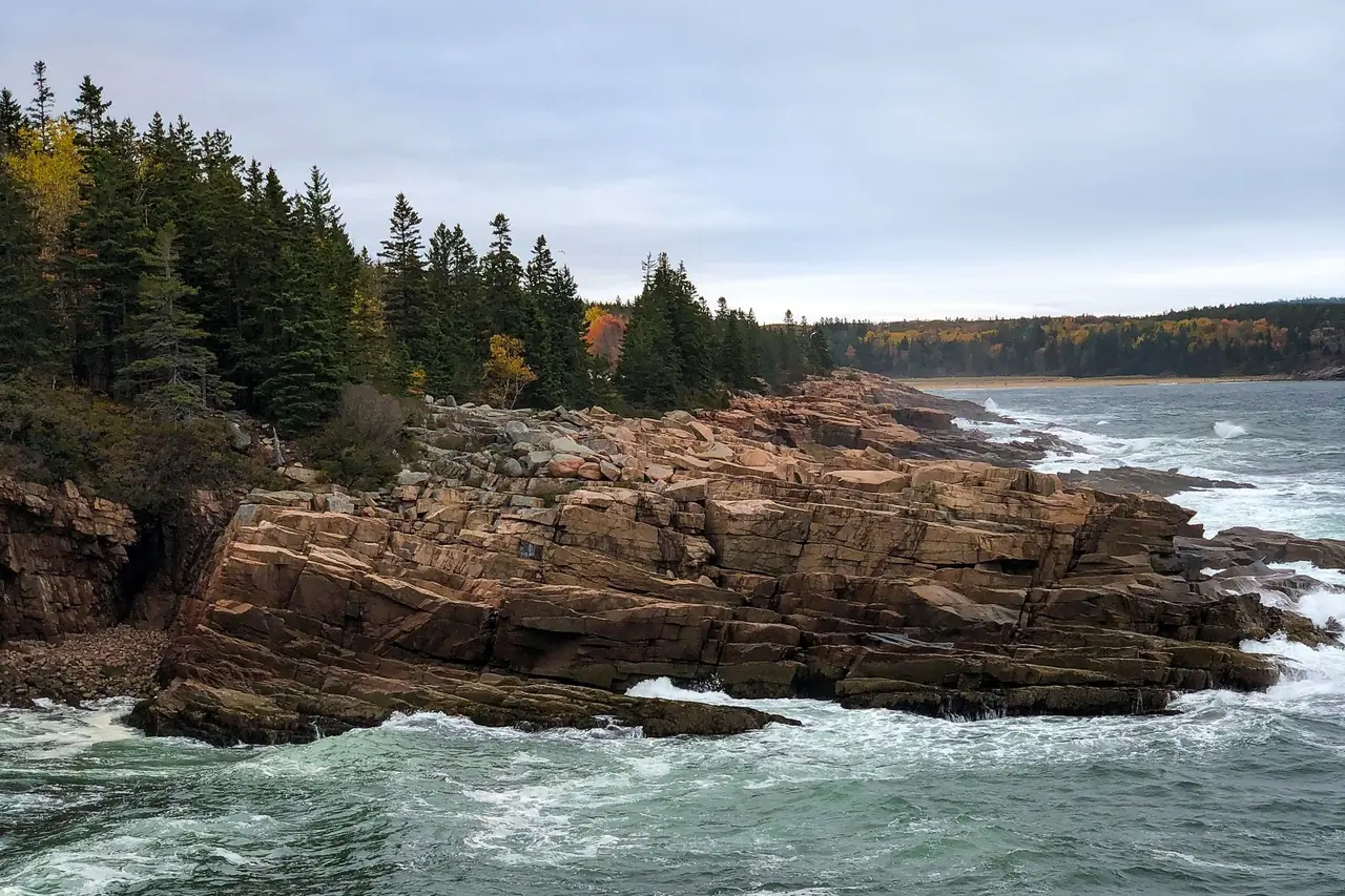
| Ocean Path | Easy | About 4 mi (6.4 km) out-and-back, Sand Beach to Otter Point | Pink granite shore, Thunder Hole, Otter Cliff |
| Jordan Pond Path | Easy | About 3.3 mi (5.3 km) loop | Clear pond, views of the Bubbles; rocky and boardwalk sections |
| Great Head Trail | Easy to moderate | About 1.7 mi (2.7 km) loop | Headland cliffs above Sand Beach; some rocky scrambling |
| South Bubble | Moderate | About 1.5 mi (2.4 km) | Bubble Rock, view down Jordan Pond |
| Gorham Mountain | Moderate | About 2 mi (3.2 km); longer as a loop with Ocean Path | Open granite ridge with ocean views; the Beehive alternative |
| Acadia Mountain | Moderate | About 2.5 mi (4 km) loop | Steep, rocky; views over Somes Sound on the quieter west side |
| Cadillac North Ridge | Moderate to strenuous | About 4.4 mi (7 km) | Steady open-ledge climb to the park's highest summit, 1,530 ft (466 m) |
| Cadillac South Ridge | Strenuous (long) | About 7 mi (11 km) | Long, gradual ridge from near Blackwoods Campground; big ocean views |
| Beehive | Strenuous, exposed | About 1.5 mi (2.4 km) loop with the Bowl | Iron rungs and narrow ledges above Sand Beach |
| Precipice | Very strenuous, exposed | About 2.5 mi (4 km) loop | Roughly 1,000 ft of near-vertical iron rungs and ladders; seasonal falcon closure |
Easy trails: Ocean Path, Jordan Pond and the carriage roads
Ocean Path
Ocean Path runs along the coast parallel to the Park Loop Road, from Sand Beach past Thunder Hole and Monument Cove to Otter Cliff and Otter Point. It's mostly level with short rocky sections, and you can hop off at any parking area along the way. The best time is early morning, before the Sand Beach and Thunder Hole lots fill. Thunder Hole is most dramatic a couple of hours before high tide with some swell running.
Jordan Pond Path
This loop circles Jordan Pond with the rounded North and South Bubbles rising at the far end. The east shore is a well-worn gravel path; the west shore crosses rocky ground and long sections of boardwalk. It starts at the Jordan Pond House, where parking fills early in summer. Swimming and wading in Jordan Pond are prohibited because it's a public water supply.
Carriage roads
Built in the early 1900s with funding from John D. Rockefeller Jr., the carriage roads are about 45 miles of wide, gently graded broken-stone roads closed to cars, linked by hand-built stone bridges. They're ideal for families, runners, cyclists and rainy days when the rocky trails are slick. Popular loops circle Eagle Lake and Jordan Pond. The roads may close temporarily during the spring thaw ("mud season") to prevent damage; check status in April and May.
Moderate summits: Bubbles, Gorham, Acadia Mountain and Cadillac
The Bubbles
From the Bubbles Divide parking area on the Park Loop Road, short, steep trails climb the South Bubble and North Bubble. South Bubble is home to Bubble Rock, a glacial erratic perched on the edge of the cliff, and a view straight down the length of Jordan Pond. Parking is very limited; the Island Explorer's Jordan Pond and Bubble Rock stops are easier in summer.
Gorham Mountain
Gorham Mountain climbs open granite ledges to a summit of about 525 feet with views over Sand Beach, Great Head and the ocean. It's the best choice for people who want Beehive-style views without the iron rungs. Combine it with Ocean Path for a loop.
Acadia Mountain
On the island's quieter west side, the Acadia Mountain loop climbs steep, rocky trail to views over Somes Sound, the fjard that nearly splits Mount Desert Island in two. It's a good escape from the Park Loop Road crowds.
Cadillac Mountain: North Ridge and South Ridge
Cadillac is the park's highest summit at 1,530 feet, with sweeping views over Bar Harbor and Frenchman Bay. Hiking is the way to reach it without the vehicle reservation the park has required for the Cadillac Summit Road in peak season (details at nps.gov/acad).
- North Ridge Trail is the shorter, more direct route, climbing steadily over open ledges near the summit road. Popular for sunrise, which means starting in the dark with a headlamp.
- South Ridge Trail is long and gradual, starting near Blackwoods Campground and passing the Eagles Crag viewpoint and the Featherbed, a small pond in a saddle below the summit.
The summit is exposed and often windy and much colder than the shore, even in summer. Pack a warm layer and wind shell.
Iron-rung trails: Beehive and Precipice
Acadia's "ladder trails" use iron rungs, handrails and ladders drilled into granite cliffs. They're among the most popular hikes in the park and they're genuinely exposed: a slip in the wrong spot could be fatal. Think of them as easy scrambling with fixed hardware; our class 3 scramble guide covers the movement skills and judgment they call for.
Beehive
The Beehive rises directly above Sand Beach. The climb is short, but the upper half follows narrow ledges and iron rungs with sustained drop-offs. Descend by the gentler back side via the Bowl, a small mountain pond, rather than down the rungs. On summer days, expect lines on the ledges; start early.
Precipice
The Precipice Trail climbs the east face of Champlain Mountain, gaining roughly 1,000 feet in well under a mile on rungs, ladders and narrow ledges. It's the most difficult hiking trail in the park and should be climbed up only; descend by a non-rung trail.
- Falcon closures: The Precipice often closes from spring into summer to protect nesting peregrine falcons, typically reopening once chicks have fledged. Other cliff trails, such as the Jordan Cliffs Trail, can also be affected. Closure and reopening dates vary each year; check trail status on the park website before you go.
- Who it's for: Fit hikers comfortable with heights and exposure. Not for young children, dogs, or anyone with a fear of heights.
Schoodic Peninsula
The Schoodic District is the only part of Acadia on the mainland, about an hour's drive from Bar Harbor (or a seasonal ferry ride from Bar Harbor to Winter Harbor). It's far quieter than Mount Desert Island. A one-way loop road follows the rocky shore to Schoodic Point, where surf crashes on wide granite ledges, and short trails such as those on Schoodic Head lead to views back across Frenchman Bay toward Cadillac. The area also has a network of bike paths and the Schoodic Woods Campground.
Getting around: the Island Explorer shuttle
The fare-free Island Explorer bus system runs several routes connecting Bar Harbor, the park's campgrounds, villages and major trailheads, including Sand Beach, Jordan Pond and the Bubbles area, with a separate route serving the Schoodic Peninsula. It typically operates from late June into mid-October; check the current schedule before you plan around it.
- Parking is the bottleneck in summer and fall. Sand Beach, Jordan Pond, the Bubbles and Cadillac fill by mid-morning on busy days.
- Use the shuttle for point-to-point hikes, such as climbing Gorham Mountain and walking back along Ocean Path, or crossing the Bubbles and catching a bus from Jordan Pond.
- An entrance pass is required to enter the park, including on the bus. Details are on the park website.
Best seasons to hike Acadia
| Season | Conditions | Hiking notes |
|---|---|---|
| Spring (Apr–early Jun) | Cool, foggy, muddy; Park Loop Road reopens; black flies by late spring | Quiet trails; carriage roads may close for thaw; Precipice usually closed for falcons |
| Summer (late Jun–Aug) | Mild, often foggy; peak crowds; shuttle running | Start early for parking and ledges; afternoon thunderstorms possible |
| Fall (Sep–Oct) | Crisp and settled; foliage typically peaks early to mid-October | The best overall hiking; peak-foliage weekends are very busy |
| Winter (Nov–Mar) | Cold, icy; most of the Park Loop Road closed to cars | Snowshoe and ski the carriage roads; avoid rung trails entirely; traction devices needed |
Compare monthly averages on our September and October weather guides, then check the forecast for your trailhead with Trail Weather, which flags wind, rain and cold that matter on the exposed summits.
Trail tips specific to Acadia
- Follow the blazes and cairns. On open granite ledges, trails are marked with blue paint blazes and Bates cairns (a distinctive stacked-stone design). Don't build or knock down cairns.
- Fog moves in fast. On open granite, the route can vanish in minutes. Carry a map (or offline map app) and know how to retrace your steps; see what to do if you get lost.
- Granite is slick when wet, and roots are slicker. Good tread matters more than ankle height.
- Bring water. There's little reliable water on the trails, and the summits are sunny and exposed.
- Pets: Leashed dogs are allowed on many trails and the carriage roads but not on the ladder trails; check the park's pet rules for specific trails.
- Want more New England granite? The White Mountains are a few hours west; see our New Hampshire hiking guide.
Pack a lightweight daypack with a wind shell, an extra warm layer and a headlamp for sunrise or late hikes. A pair of traction cleats makes shoulder-season and winter hiking on icy ledges and carriage roads far safer.
Frequently asked questions
What is the most popular hike in Acadia National Park?
The Beehive, Ocean Path and Jordan Pond Path are among the busiest. The Beehive is a short iron-rung climb above Sand Beach, Ocean Path is an easy coastal walk past Thunder Hole, and Jordan Pond Path is a mostly flat loop around the pond with views of the Bubbles.
Is the Precipice Trail open?
The Precipice Trail often closes from spring into summer to protect nesting peregrine falcons, and reopens once the chicks have fledged. Closure dates vary by year, so check the trail status on nps.gov/acad before you go.
Can you hike Cadillac Mountain without a reservation?
Yes. The vehicle reservation applies to driving the Cadillac Summit Road in peak season, not to hiking. You can reach the summit on foot by the North Ridge, South Ridge or other trails without a reservation.
What is the easiest hike in Acadia?
Ocean Path, Jordan Pond Path and the carriage roads are the easiest. Ocean Path follows the shore from Sand Beach to Otter Point, Jordan Pond Path loops around the pond on mostly level ground, and the carriage roads are wide, graded gravel paths.
When is the best time to hike in Acadia?
Late June through mid-October. September and early October bring cooler temperatures, fewer bugs and fall color, typically peaking in early to mid-October. Iron-rung trails are dangerous when wet or icy, so avoid them in rain and late fall.