Best time to visit
Mid-July through mid-September is the best time to visit the Cloud Peak Wilderness, when high trails and passes are mostly snow-free and lakes are thawed. Early September is the quietest part of that window.
| Best for hiking | Mid-July to mid-September |
|---|---|
| Best for camping | July to September |
| Best for fewer crowds | After Labor Day |
| Best for photography | Late July for wildflowers; September for clear skies |
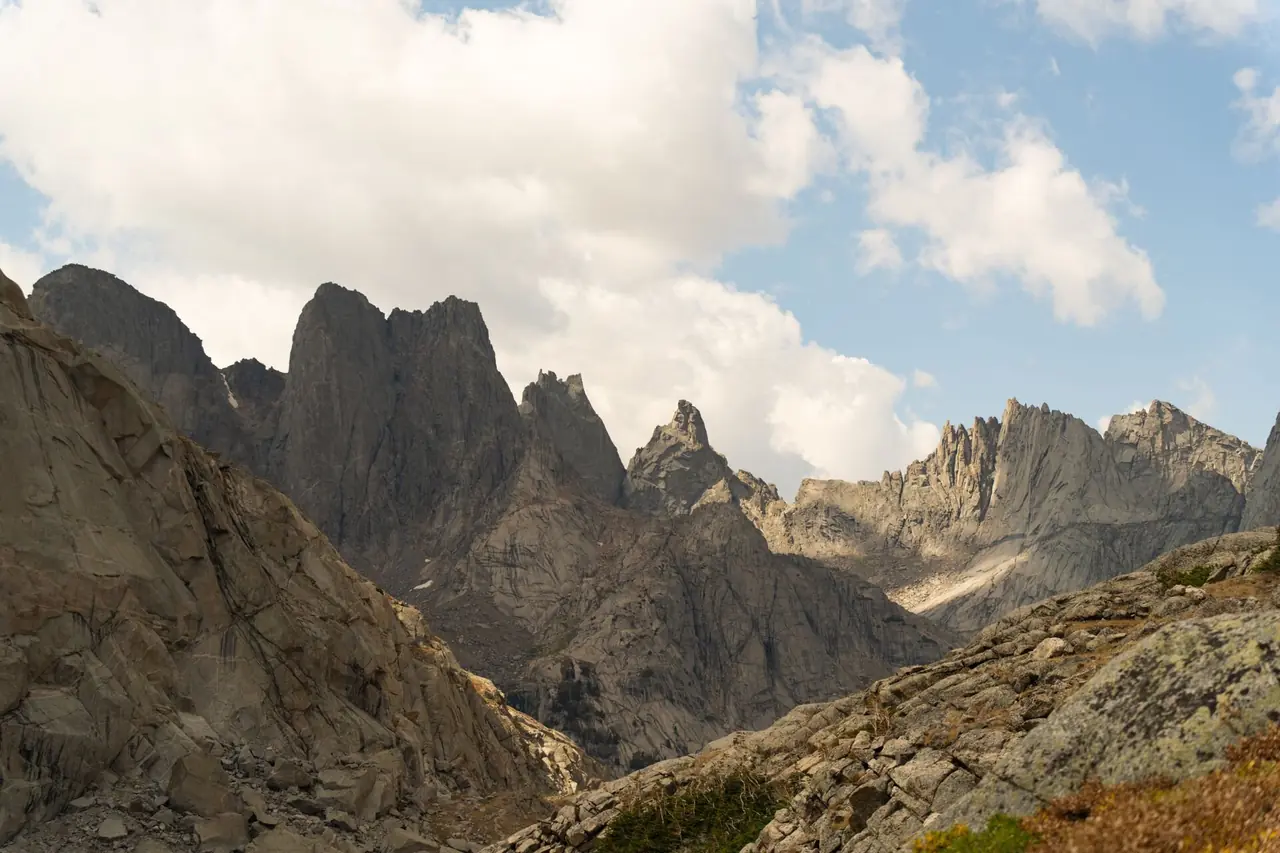
The Cloud Peak Wilderness protects the high, granite core of Wyoming's Bighorn Mountains in Bighorn National Forest, including 13,167-foot Cloud Peak, the range's highest summit. It is a land of alpine lakes, cirques and boulder fields with no roads and far fewer visitors than the national parks to the west.
The hiking season is short. Snow can block high trails and passes well into July, summer afternoons bring thunderstorms, and winter turns the wilderness into a remote snowbound area reachable only by serious winter travelers.
Month-by-month weather at Bighorn high country
Ten-year averages (2015–2024) at Bighorn high country, about 9,515 ft. Higher trails are colder, windier and snowier — temperatures typically drop 3–5°F for every 1,000 ft you climb.
Hiking & camping weather score by month
Average high and low temperature (°F)
Average precipitation (inches per month)
| Month | Avg high | Avg low | Precip | Wet days | Snow | Freezing nights | Sun/day | Score |
|---|---|---|---|---|---|---|---|---|
| January | 23°F | 9°F | 1.7 in | 11 | 12 in | 31 | 7 h | Poor |
| February | 21°F | 7°F | 2.2 in | 11 | 16 in | 28 | 8 h | Poor |
| March | 28°F | 13°F | 2.6 in | 13 | 18 in | 31 | 10 h | Poor |
| April | 33°F | 18°F | 3.8 in | 15 | 26 in | 29 | 10 h | Poor |
| May | 41°F | 26°F | 4.8 in | 17 | 26 in | 25 | 12 h | Poor |
| June | 55°F | 36°F | 3.0 in | 15 | 4 in | 6 | 14 h | Fair |
| July | 64°F | 44°F | 3.3 in | 16 | 1 in | 0 | 14 h | Good |
| August | 62°F | 43°F | 3.2 in | 17 | 1 in | 0 | 13 h | Good |
| September | 55°F | 37°F | 2.7 in | 9 | 9 in | 7 | 11 h | Good |
| October | 40°F | 24°F | 3.0 in | 10 | 18 in | 23 | 9 h | Poor |
| November | 30°F | 15°F | 1.9 in | 10 | 13 in | 28 | 8 h | Poor |
| December | 22°F | 9°F | 1.5 in | 10 | 11 in | 31 | 7 h | Poor |
Score rates hiking and tent-camping weather only (temperature, rain, snow and heat) — it doesn't account for crowds, road closures or permits, which are covered in the seasonal notes. Data: Open-Meteo historical weather API (ERA5 reanalysis), adjusted to the hub elevation.
7-day forecast and hike score
Loading forecast…
Open in the trail forecast tool to check other trailheads.
Season by season
Spring
Spring is still winter in the high country. Deep snow covers the wilderness, and many access roads to trailheads remain closed or impassable. Lower-elevation forest areas begin to thaw by late spring.
The highways across the Bighorns are maintained, but forest roads to trailheads are not plowed.
Summer
Summer opens the high country, usually by mid-July. Lakes thaw, wildflowers bloom and backpackers head to Mistymoon Lake, Lake Solitude and other basins. Afternoon thunderstorms are common; plan to be off summits and exposed ridges early.
Mosquitoes can be thick in early summer near lakes and meadows.
Fall
September brings clear, crisp days, cold nights and few people. Snow can return any time, and hunting season brings more activity in the surrounding forest.
By October, high trails are often snow-covered.
Winter
Winter is cold and snowbound. The highways crossing the Bighorns are generally maintained, but trailheads and the wilderness are reachable only on skis or snowshoes. Avalanche terrain is common.
Winter travel here is for experienced backcountry users only.
Hikes worth timing right
| Hike | Level | Notes |
|---|---|---|
| Cloud Peak via West Tensleep and Mistymoon Lake | Strenuous | Long route to the range's high point, finishing on a class 2 boulder field; usually done as a two- or three-day trip. |
| Mistymoon Lake | Strenuous | Hike from West Tensleep to a lake near treeline, the usual base camp for Cloud Peak. |
| Lake Solitude | Strenuous | Large alpine lake below rugged cliffs; reachable from several trailheads as a long day or overnight. |
| Lost Twin Lakes | Moderate | Hike from the Tensleep area to two lakes beneath a dramatic cirque. |
Camping at Cloud Peak Wilderness
Bighorn National Forest has numerous campgrounds along US 16 and US 14, including near West Tensleep Lake. Many book through Recreation.gov, while others are first-come, first-served. Dispersed camping is allowed in much of the national forest outside the wilderness.
Inside the wilderness, visitors are asked to fill out a free registration at the trailhead. Follow wilderness rules, including camping setbacks from water and trails and any campfire restrictions. The Bighorns are black bear country: store food in a bear-resistant canister or hang it properly.
Know before you go
- Visitors are asked to fill out a free registration at the trailhead; check the Bighorn National Forest website for current rules.
- Snow can block high trails into July; plan accordingly.
- Afternoon thunderstorms are common; be off summits and exposed ridges early.
- The area is remote, and cell service is limited or absent.
- Black bears are present; store food properly.
- Elevations above 9,000 feet can cause altitude sickness.
Official information, alerts and current conditions: www.fs.usda.gov/bighorn.
Frequently asked questions
What is the best month to visit the Cloud Peak Wilderness?
August is the best single month, with most high trails snow-free and lakes thawed. Late July and early September are also good.
When is the Cloud Peak Wilderness most crowded?
Midsummer weekends see the most visitors, especially at popular areas like Mistymoon Lake. Even then, it is far less crowded than the national parks.
Can you camp in the Cloud Peak Wilderness in winter?
Yes, but only experienced winter travelers should attempt it. Expect deep snow, extreme cold and avalanche terrain.
How many days do you need in the Cloud Peak Wilderness?
Plan at least two to three days for a backpacking trip to Mistymoon Lake or Cloud Peak. Longer trips allow exploration of more remote basins.