This guide contains affiliate links. If you buy through them, Arrive Outdoors may earn a commission at no extra cost to you. Learn more.
The best Zion hiking trails fit almost any ability: Pa'rus Trail and Riverside Walk for easy paved walks, Emerald Pools, Watchman and Canyon Overlook for short moderate hikes, and Angels Landing (permit required), The Narrows and Observation Point via the East Mesa Trail for the park's signature big days. Most trails start along the Zion Canyon Scenic Drive, which is shuttle-only for much of the year, and the two biggest hazards on any of them are flash floods and heat. The table below sorts the main trails by difficulty, followed by how to get there, permits and when to go.
For month-by-month weather, campgrounds and seasonal tips, see the Zion National Park destination guide.
Zion trails by difficulty
Distances are approximate round trips; trail conditions and rockfall closures change, so check the park's current trail status before you go.
| Trail | Difficulty | Distance (round trip) | Start | Notes |
|---|---|---|---|---|
| Pa'rus Trail | Easy | About 3.5 mi (5.6 km) | Visitor center / South Campground | Paved and flat; the only trail open to pets and bikes |
| Riverside Walk | Easy | About 2.2 mi (3.5 km) | Temple of Sinawava | Paved, shaded canyon walk to the start of The Narrows |
| Lower Emerald Pool | Easy | About 1.2 mi (1.9 km) | Zion Lodge | Short walk under a seasonal waterfall |
| Middle & Upper Emerald Pools | Moderate | About 3 mi (4.8 km) | Zion Lodge or the Grotto (via Kayenta Trail) | Sandy, rocky climb to the upper pool beneath cliffs |
| Watchman Trail | Moderate | About 3.3 mi (5.3 km) | Visitor center | Views over Springdale and the Watchman; good in winter |
| Canyon Overlook | Moderate (short) | About 1 mi (1.6 km) | East of the Zion-Mount Carmel Tunnel | Ledges with drop-offs and some railings; tiny parking lots |
| Scout Lookout | Strenuous | About 4 mi (6.4 km) | The Grotto | Steep paved switchbacks including Walter's Wiggles; no permit needed |
| Angels Landing | Strenuous, exposed | About 5.4 mi (8.7 km), roughly 1,500 ft (450 m) gain | The Grotto | Permit required beyond Scout Lookout; chain-assisted ridge with big drop-offs |
| The Narrows (bottom-up) | Moderate to strenuous | Your choice, up to Big Spring (about 10 mi / 16 km) | Temple of Sinawava | Wading in the river; flow and flash-flood dependent |
| Observation Point via East Mesa | Moderate | About 7 mi (11 km) | East Mesa Trailhead, outside the east side of the park | Mostly level mesa-top hike to one of Zion's best views; rough access road |
| Timber Creek Overlook | Easy | About 1 mi (1.6 km) | End of Kolob Canyons Road | Short ridge walk with views over the Kolob finger canyons |
| Taylor Creek | Moderate | About 5 mi (8 km) | Kolob Canyons Road | Creek-side hike past historic cabins to Double Arch Alcove |
| Kolob Arch via La Verkin Creek | Strenuous | About 14 mi (22.5 km) | Lee Pass, Kolob Canyons Road | Long day or overnight (permit) to one of the world's longest arches |
Easy hikes: Pa'rus, Riverside Walk, Lower Emerald Pool
Pa'rus Trail follows the Virgin River from the visitor center up the canyon to Canyon Junction, with views of the Watchman and the Towers of the Virgin. Because it starts at the visitor center you can walk it without the shuttle, and it's the one trail in the park where leashed dogs and bicycles are allowed.
Riverside Walk, at the last shuttle stop (Temple of Sinawava), is a paved path along the river as the canyon tightens. It ends where the pavement stops and The Narrows begins, so it doubles as a preview of the river hike. Look for hanging gardens on the seeping walls.
Lower Emerald Pool starts across the footbridge from Zion Lodge and passes behind a thin waterfall that flows best in spring and after rain.
Moderate hikes: Emerald Pools, Watchman, Canyon Overlook
Middle and Upper Emerald Pools continue up from the lower pool on sandy, rocky trail. The upper pool sits in an amphitheater beneath sheer cliffs. A pleasant loop links the pools with the Kayenta Trail to the Grotto shuttle stop.
Watchman Trail starts at the visitor center, so it's handy on arrival day or when shuttle lines are long. It climbs a few hundred feet to a mesa bench with views over the lower canyon and Springdale. Because it sits low and gets sun, it's a good winter option when upper trails are icy, and a poor choice on a summer afternoon.
Canyon Overlook is on the east side of the Zion-Mount Carmel Tunnel, outside the main canyon (no shuttle needed). It's short but rugged, with steps, uneven rock and exposed ledges, some protected by railings, leading to a view straight down Pine Creek and into lower Zion Canyon. The small parking areas fill early; arrive near sunrise.
Angels Landing and the permit lottery
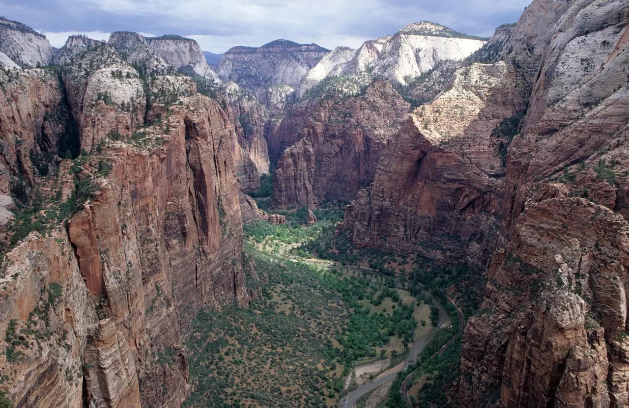
The trail climbs from the Grotto on the West Rim Trail, up a series of switchbacks and the tight zigzags of Walter's Wiggles, to Scout Lookout. From there, the last half mile follows a narrow fin of sandstone with chains bolted to the rock and drops of more than 1,000 feet on both sides in places.
- A permit is required to hike beyond Scout Lookout. Permits are issued by lottery on Recreation.gov, with a seasonal advance lottery and a day-before lottery. Lottery periods and the application fee are set by the park; get the current details at nps.gov/zion.
- No permit? Hike to Scout Lookout. It's still a strenuous climb with big views into Zion Canyon and over to the chains.
- Know your limits. The chain section involves scrambling with real exposure. It is not appropriate for anyone uneasy with heights or for young children, and it is dangerous when wet, icy or windy. Our class 3 scramble guide explains the movement skills and judgment calls involved.
The Narrows from the bottom up
The bottom-up Narrows is a day hike that starts at the end of the Riverside Walk and travels upstream in the North Fork of the Virgin River, wading and sometimes swimming between walls that rise hundreds of feet. You turn around whenever you like; without a permit, day hikers can go as far as Big Spring. Many people turn back at or just past the famous Wall Street section, where the canyon is narrowest.
- Check flow and forecast first. The park closes The Narrows when river flow exceeds its safe limit, which often happens during spring snowmelt and after storms. The visitor center posts flow and flash-flood potential daily.
- Gear: Closed-toe shoes with good grip (not sandals), neoprene socks in cool water, and a sturdy walking stick or trekking poles for balance on slick, rounded rocks. Outfitters in Springdale rent canyoneering shoes, drysuits and poles.
- Water temperature is cold much of the year; in spring and fall, drysuits or wetsuit layers make the trip comfortable and safer.
- Top-down trips from Chamberlain's Ranch (about 16 miles) and any overnight camping in The Narrows require a wilderness permit.
Observation Point via the East Mesa Trail
Observation Point looks straight down Zion Canyon from above Angels Landing, and many hikers rank it as the park's best view. The classic route from Weeping Rock on the canyon floor has been closed by rockfall, so the way in now is the East Mesa Trail, which starts outside the park's east boundary and follows a mostly gentle path across the mesa top through ponderosa pine to the point.
The catch is the access road. The dirt road to the trailhead can be rough and is often impassable for low-clearance vehicles, especially when wet or snowy. Many hikers use a shuttle service from the East Zion area or park lower and walk farther. Check road conditions before you go.
Kolob Canyons: Zion without the crowds
Kolob Canyons is a separate section of the park in the northwest, reached from its own exit off Interstate 15 north of the main canyon, with no road connection to Zion Canyon. It sees a fraction of the visitors.
- Timber Creek Overlook: a short walk at the end of the scenic Kolob Canyons Road with views over the red finger canyons.
- Taylor Creek (Middle Fork): a moderate creek-side trail with many crossings, past two historic homestead cabins to Double Arch Alcove.
- Kolob Arch: a long, strenuous out-and-back via Timber Creek and La Verkin Creek to one of the longest natural arches in the world. Many hikers make it an overnight with a wilderness permit.
The higher Kolob Terrace area, reached by Kolob Terrace Road from the town of Virgin, has more quiet trails such as Northgate Peaks; it's seasonal and often snowbound in winter.
Getting there: the Zion Canyon shuttle
For much of the year, Zion Canyon Scenic Drive is closed to private vehicles and served by the free park shuttle, which stops at every major trailhead from the visitor center to the Temple of Sinawava. When the shuttle isn't running, usually in parts of winter, you can drive the scenic drive yourself. A separate town shuttle has served Springdale, letting you leave your car at your lodging.
- The shuttle season, hours and any ticket or reservation requirements change; check the park's shuttle page before you go.
- Visitor center parking fills early in busy seasons, often by mid-morning. Arrive early or use the Springdale shuttle.
- For Angels Landing and The Narrows, catch an early shuttle. Lines at the visitor center can be long by mid-morning on busy days.
- Canyon Overlook, the East Mesa Trail and Kolob Canyons are all reached by car, not the canyon shuttle.
Flash floods and heat safety
Zion's two most dangerous hazards are predictable if you plan for them.
Flash floods
- Flash floods can occur at any time of year but are most common during the summer monsoon (roughly July through September).
- Storms miles away, upstream and out of sight, can send a wall of muddy water and debris through The Narrows and slot canyons with little warning.
- Check the flash-flood potential at the visitor center or on the National Weather Service forecast before any canyon or river hike, and don't enter narrow canyons if storms are forecast anywhere in the area.
- Warning signs: water rising or turning muddy, floating debris, a roaring sound upstream. Climb to high ground immediately; don't try to outrun a flood downstream.
Heat
- Summer highs on the canyon floor frequently top 100°F (38°C), and exposed trails like Angels Landing, Watchman and the Emerald Pools climb are hotter in the sun.
- Start strenuous hikes at dawn, carry plenty of water and salty snacks, and rest in shade through the hottest hours. A sun hoodie and wide-brimmed hat help a lot.
- Know the signs of heat exhaustion (heavy sweating, nausea, dizziness, headache) and heat stroke (confusion, hot skin, collapse — call 911).
When to hike in Zion
| Season | Conditions | Best hikes |
|---|---|---|
| Spring (Mar–May) | Mild, busy; waterfalls flowing; The Narrows often closed by snowmelt | Emerald Pools, Angels Landing, Watchman, Kolob Canyons |
| Summer (Jun–Aug) | Very hot; monsoon storms from July; peak crowds | The Narrows (when open), early-morning Angels Landing, Observation Point via East Mesa |
| Fall (Sep–Nov) | Cooling, settled weather; cottonwood color by late October to November | Everything, especially The Narrows in September and October and Kolob Canyons |
| Winter (Dec–Feb) | Cool to cold; ice and snow on upper trails; quietest season | Pa'rus, Watchman, Riverside Walk; Angels Landing only if dry and ice-free |
See average temperatures by month on our April, October and other monthly weather guides. If you're adding nearby parks, Bryce Canyon sits much higher and runs far cooler than Zion in summer.
Frequently asked questions
What is the best hike in Zion?
Angels Landing and The Narrows are the two signature hikes. Angels Landing needs a permit from the park's lottery; The Narrows bottom-up day hike needs no permit but depends on river flow and flash-flood conditions. For a big view without a permit, Observation Point via the East Mesa Trail and Scout Lookout are excellent alternatives.
What is the easiest hike in Zion?
The Pa'rus Trail and Riverside Walk are both paved, mostly flat and about 2 to 3.5 miles round trip. The Lower Emerald Pool Trail is another easy option, about 1.2 miles round trip.
Do you need a permit to hike Angels Landing?
Yes. A permit is required to hike the chained section beyond Scout Lookout, and permits are issued by lottery through Recreation.gov, with both advance and day-before lotteries. You can hike to Scout Lookout without one. Check nps.gov/zion for current lottery dates.
Can you hike The Narrows without a permit?
Yes. You can hike upstream from the end of the Riverside Walk as far as Big Spring and back without a permit. Hiking the full Narrows top-down from Chamberlain's Ranch or camping overnight requires a wilderness permit. The Narrows closes when river flow is too high.
When is the best time to hike in Zion?
April to May and mid-September to November offer the most comfortable temperatures. Summer is very hot on exposed trails and brings monsoon flash-flood risk, and winter can leave upper trails icy.