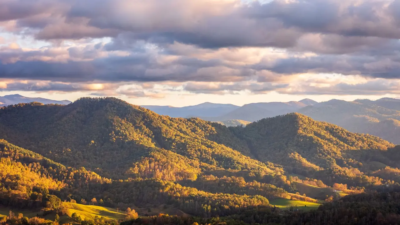
The best hiking in the Smoky Mountains is on Alum Cave Trail, the Appalachian Trail to Charlies Bunion, Ramsey Cascades, Andrews Bald and Mount Cammerer, with Grotto Falls, Abrams Falls and the Kuwohi tower walk as easier picks. The table below sorts ten classic trails by difficulty so you can match them to your group. Before you go, know three things: every parked car needs a parking tag, the summits can be 10 to 20°F colder than Gatlinburg, and this is black bear country.
The 10 best Smoky Mountains hikes at a glance
Distances are round trip and approximate. Elevation gain is rounded. Use them to compare trails, then confirm current conditions with the park.
| Trail | Difficulty | Round trip | Gain | Payoff |
|---|---|---|---|---|
| Kuwohi observation tower | Easy (steep) | 1 mi | ~330 ft | Highest point in the park, 360° view |
| Grotto Falls (Trillium Gap Trail) | Easy | 2.6 mi | ~550 ft | Walk behind a waterfall |
| Andrews Bald | Moderate | 3.6 mi | ~1,000 ft | Grassy bald, azaleas in June |
| Chimney Tops (to overlook) | Moderate–strenuous | ~3.5 mi | ~1,400 ft | View of the pinnacles; short, very steep |
| Abrams Falls | Moderate | 5 mi | ~600 ft | Wide, powerful falls in Cades Cove |
| Alum Cave Trail to the bluffs | Moderate | 4.6 mi | ~1,100 ft | Arch Rock, Inspiration Point, huge overhang |
| Rainbow Falls | Strenuous | 5.4 mi | ~1,500 ft | 80-foot falls, rocky steady climb |
| Charlies Bunion (via the AT) | Strenuous | 8 mi | ~1,600 ft | Rock outcrop with big drop-offs and views |
| Ramsey Cascades | Strenuous | 8 mi | ~2,200 ft | Tallest waterfall in the park, old-growth forest |
| Mount Cammerer | Very strenuous | ~11 mi | ~3,000 ft | Stone fire lookout with views into Tennessee and North Carolina |
Plug any of these into the hiking time calculator to estimate your time with the climbing included. Smokies trails are rocky and root-covered, so most people move slower here than the mileage suggests.
Easy hikes
Kuwohi observation tower
Kuwohi (6,643 ft) is the highest point in the park and in Tennessee. It was officially renamed from Clingmans Dome in 2024, restoring its Cherokee name; you'll still see the old name on older maps and signs. From the parking area at the end of Kuwohi Road, a paved path climbs about half a mile to the concrete observation tower. It's short but steep, and at this elevation many visitors feel it. On clear days the view stretches across ridge after ridge; on many days you'll be inside a cloud. The access road closes in winter, so check the park's road status page before you drive up.
Grotto Falls
Grotto Falls is reached by the Trillium Gap Trail off the Roaring Fork Motor Nature Trail near Gatlinburg. The path climbs gently through hemlock and hardwood forest to a waterfall you can walk behind. It's one of the best family hikes in the park. The motor nature trail is one-way and closes in winter, and parking at the trailhead is limited, so arrive early. Trillium Gap Trail is also the route the llama trains use to resupply LeConte Lodge; step aside and give them room.
A note on Laurel Falls
Laurel Falls is usually on every "best easy hikes" list, but the trail has been closed for long rehabilitation work. Check its status on nps.gov/grsm before planning around it, and use Grotto Falls as your backup.
Moderate hikes
Alum Cave Trail to Alum Cave Bluffs
If you only do one hike, make it this one. Starting on Newfound Gap Road (US 441), the trail follows a creek, climbs through Arch Rock (a natural tunnel with stone steps), passes the Inspiration Point viewpoint and reaches Alum Cave Bluffs, a massive overhang, at about 2.3 miles. Strong hikers continue another 3.2 miles to the summit of Mount LeConte (6,593 ft) for an 11-mile day with roughly 2,800 feet of gain. Above the bluffs the trail has exposed ledges with cables; they're manageable in good conditions and dangerous with ice. The two trailhead lots fill early on weekends and in October.
Andrews Bald
From the Kuwohi parking area, the Forney Ridge Trail drops to Andrews Bald, the highest grassy bald in the park at about 5,900 feet. Flame azaleas and rhododendron bloom here in June, and it's a fine picnic spot with views south toward Fontana Lake. Note that you hike downhill first, so the rocky climb comes at the end when you're tired.
Abrams Falls
Abrams Falls is in Cades Cove, off the one-way loop road. The trail follows Abrams Creek over a few short ridges to a waterfall only about 20 feet tall but carrying a lot of water into a deep pool. Don't swim here: the currents at the base are strong and people have drowned. Driving the Cades Cove loop can take far longer than you expect on busy days, and the loop is closed to cars on some days in season, so check the schedule.
Chimney Tops
Chimney Tops is short but steep, climbing about 1,400 feet in less than 2 miles with stone steps much of the way. Since the 2016 Chimney Tops 2 fire, the trail ends at an observation point below the rocky pinnacles. The old scramble to the top is closed because of fire damage and erosion; respect the barrier.
Strenuous hikes
Rainbow Falls
Rainbow Falls Trail starts on Cherokee Orchard Road above Gatlinburg and climbs steadily on a rocky path to an 80-foot waterfall named for the rainbows its spray creates on sunny afternoons. It continues to Mount LeConte if you want a longer day. The rocks near the falls are slick; stay on the trail.
Charlies Bunion
From Newfound Gap, follow the Appalachian Trail north (east, by compass) along the state-line ridge for about 4 miles to Charlies Bunion, a bare rock knob with sheer drops. The first two miles climb steadily, then the trail rolls along the crest through spruce-fir forest. The views are among the best in the park, but the edges are unforgiving: keep kids close and stay off wet rock. Newfound Gap Road can close for snow and ice in winter.
Ramsey Cascades
In the Greenbrier area, this trail climbs about 2,200 feet in 4 miles, passing through some of the park's old-growth forest, including very large tulip trees, to the tallest waterfall in the park at about 100 feet. The last stretch is a scramble over roots and rocks. Do not climb on the cascades: people have died falling from the top. Greenbrier road and trail access has had closures for storm and bridge repairs, so check status before you go.
Mount Cammerer
From the Cosby area, the Low Gap Trail climbs to the Appalachian Trail, which leads to a short spur and the Mount Cammerer fire lookout, a stone-and-timber tower built by the Civilian Conservation Corps. Expect about 11 miles and close to 3,000 feet of climbing. It's quieter than the Newfound Gap trails and the view over the Pigeon River gorge is one of the best in the eastern park. Start early: this is a full day.
Parking tags, permits and crowds
- Parking tags: The park has no entrance fee, but any vehicle parked for more than 15 minutes needs a parking tag displayed. Daily, weekly and annual tags are sold online and at visitor centers. Prices and details are on the park's fees page.
- Backpacking: Overnight trips need a backcountry permit and a reserved campsite or shelter. Reserve through the park's backcountry permit system linked from nps.gov/grsm.
- Crowds: This is the most visited national park in the country. At popular trailheads (Alum Cave, Grotto Falls, Chimney Tops, Rainbow Falls), arrive before about 8 a.m. on weekends and in October, or hike on weekdays.
- Closures: Roads, trails and bridges close for storm damage, rehabilitation and winter weather. Check the park's alerts and road status the morning you go.
When to hike: season by season
| Season | What to expect | Best picks |
|---|---|---|
| Spring (Mar–May) | Wildflowers, strong waterfalls, mud; snow possible up high into April | Grotto Falls, Ramsey Cascades, Abrams Falls |
| Summer (Jun–Aug) | Hot and humid in the valleys, frequent afternoon thunderstorms, cooler on the crest | Andrews Bald, Charlies Bunion, Kuwohi (start early) |
| Fall (Sep–Nov) | Color starts at high elevations and moves down; peak crowds in October | Alum Cave, Mount Cammerer, Charlies Bunion |
| Winter (Dec–Feb) | Quiet, views through bare trees; ice on high trails; Kuwohi Road and Roaring Fork closed | Low-elevation trails like Abrams Falls; Alum Cave only with traction |
For month-by-month temperatures and rain, see the Great Smoky Mountains destination guide or the October weather guide if you're planning a fall trip.
Weather changes with elevation
The park ranges from under 1,000 feet to over 6,600 feet, and temperatures drop as you climb. The National Park Service notes mountaintops can be 10 to 20°F cooler than the lowlands. A 75°F day in Gatlinburg can mean 55°F, wind and fog on the Appalachian Trail. Rainfall is heavy too: the park averages around 55 inches a year in the valleys and up to about 85 inches on some peaks.
- Pack a rain jacket and an insulating layer on every hike above about 5,000 feet, even in summer.
- Summer thunderstorms build in the afternoon. Be off exposed spots like Charlies Bunion and the Kuwohi tower by early afternoon if storms are forecast.
- In winter, high trails can be icy while low trails are bare. Carry microspikes for Alum Cave, Chimney Tops and the AT.
- Stream crossings rise fast after heavy rain. If a crossing looks fast and above your knees, turn around.
Black bears and other safety
The park is home to roughly 1,900 black bears, and you may see one on almost any trail. Park rules prohibit willfully approaching within 50 yards (150 feet) of a bear or elk, or any distance that disturbs it.
- If a bear notices you and changes its behavior, back away slowly. Don't run.
- If a bear follows or approaches you, stand your ground, make yourself look big and make noise. If a black bear attacks, fight back.
- Never leave food or packs unattended. On overnight trips, use the food-storage cables at backcountry sites.
- Carry a map or downloaded offline map; cell service is spotty. If you get turned around, read what to do if you get lost in the woods.
- Treat stream water before drinking it.
What to bring on a Smokies day hike
- Shoes with good grip for wet rock and roots; trail runners or light boots both work.
- Water: at least 1 liter (about 1 quart) for short hikes, 2 to 3 liters for the strenuous trails in summer. The water calculator fine-tunes it.
- Rain jacket and a warm layer, whatever the forecast.
- Headlamp, in case the hike runs long. Fall days are short.
- Parking tag on your dashboard.
- Trekking poles help a lot on the steep descents from Chimney Tops, Rainbow Falls and Ramsey Cascades.
Want something less crowded with a similar feel? The Blue Ridge views and waterfalls of Shenandoah National Park are a good next trip, and the Trip Finder ranks parks near you by this month's hiking weather.
Frequently asked questions
What is the most popular hike in the Smoky Mountains?
Alum Cave Trail is one of the most popular. It passes Arch Rock and reaches Alum Cave Bluffs at about 2.3 miles, and continues to the summit of Mount LeConte. Short waterfall walks such as Grotto Falls and Laurel Falls also draw big crowds.
Do you need a parking tag to hike in the Smoky Mountains?
Yes. The park has no entrance fee, but any vehicle parked in the park for more than 15 minutes must display a parking tag. Daily, weekly and annual tags are sold online and at visitor centers. Check nps.gov/grsm for current prices and rules.
Can you still hike to the top of Chimney Tops?
No. Since the 2016 Chimney Tops 2 fire, the trail ends at an observation point below the rocky pinnacles. The route beyond it is closed because of fire damage and erosion.
What is the best month to hike the Smoky Mountains?
October for fall color and cool temperatures, and late April through May for wildflowers and waterfalls at full flow. Both are busy. Summer is hot and humid at low elevations with frequent afternoon thunderstorms, and winter can close high roads.
What is Kuwohi?
Kuwohi is the highest point in Great Smoky Mountains National Park at 6,643 feet. It was officially renamed from Clingmans Dome in 2024, restoring its Cherokee name. A steep paved half-mile path leads to the observation tower.